It starts with seagulls. Between 30,000 and 40,000 birds are nesting around the Kabushima Shrine, a beautiful building nestled on a rock formation on the shores of Hachinohe. Umbrellas with white marks are ready for visitors to borrow… for obvious reasons. We had just bought French pastries, and I clutch the bag tightly while walking through the birds. I feel the 60,000 eyes staring at the little brown bag in my hands. It is incredibly loud, and we are happy to take a few first steps on the Michinoku trail before taking a break, at a safe distance from those hungry gazes.

General information
The Michinoku Coastal Trail goes from Hachinohe, Kabushima Shrine to Soma City, or the other way around. It crosses the following prefectures: Aomori, Iwate, Miyagi, and Fukushima.
- Length: approximately 1,044 kilometers
- Elevation gain: approximately 35,000 meters
- Difficulty: easy terrain without technical sections, but depending on your condition and experience, it can still be a challenge. Very suitable for a first long-distance hike.
This trail passes through small villages with restaurants and convenience stores. You will not need to carry an excessive amount of food with you. Likewise, there are campsites along the trail that you can use. However, the distance between the campsites can be longer than you might expect, so we would recommend checking the distances first and potentially adding accommodations in between to split the sections. We did the trail in early April, and while the campgrounds were still closed, we were still able to pitch a tent. But do not expect the facilities to be open outside of the season. Additionally, we just used parks and beaches for wild camping, which we wouldn’t recommend in summer. This early in the season, and pitching our tent after nightfall and leaving early while respecting the Leave No Trace rule, we did not feel that we disturbed anyone.
Even though we only had time for a small section of the trail, we definitely recommend walking the Michinoku Trail. It passes many shrines and temples, rural towns and villages, and provides information about the tsunamis and local projects along the way. You will be able to observe fishermen collecting seaweed, the elderly lovingly tending to their gardens, and a mix of generations relaxing in the public onsens, among much more that defines rural life in Japan. Not as grand as the cities in the south like Osaka and Kyoto, with less than 2% of tourists venturing to this part of the country, this trail gives you the chance to discover the life of untouristic rural Japan.
The journey
Day 1: Kabushima Shrine to a wild camp near Oja / 20 km

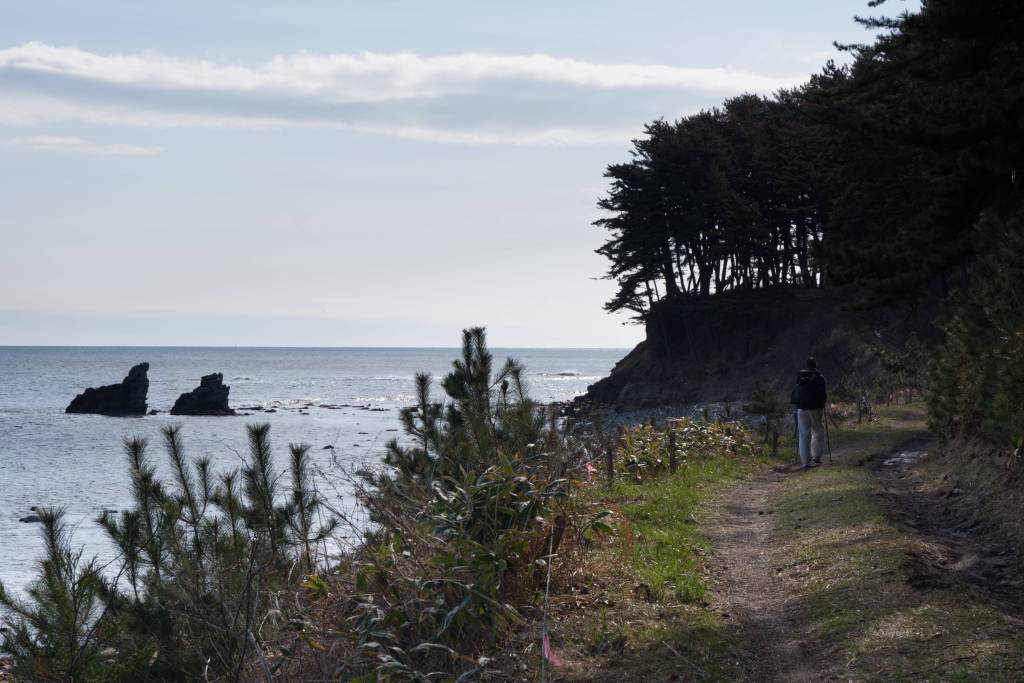
The trail starts at the seagull Kabushima Shrine and looks very promising. The first kilometers along the coast are touristic, and there are viewpoints and ice cream. Slowly, we walk further away from the crowds, first on top of a cliff, then along an endless sand beach, and finally through a pine forest. The smell of the sea and pines is divine after a long winter.
We started on the trail a bit late, so we do not make it to the campground we were planning on reaching and set up camp on a grassy patch close to the water. After a long dinner preparation, we retreat to our tent. The temperature drop after nightfall is quite important. We quickly fall asleep to the sound of the waves.
Day 2: Wild camp to Hashikami mountain hut / 20 km
After a first day along the coast, the trail takes a detour to Hashikami Mountain. We get some food at the local Lawson and walk for approximately 10 km to the start of the mountain trail. With 739 meters, it’s the biggest elevation gain on this trail. We had already seen the snow from the coast, but we are surprised how low it starts. We slowly make our way to the top, with occasional sliding and slipping.
At the very top, the sun joins the party for a few minutes, and we can enjoy a beautiful view. There are multiple unmanned mountain huts nestled a few meters below the top, and as there is still a lot of snow and we are not sure where to camp, we decide to sleep in one of them. If you are too early in the season, or you don’t feel like it, it’s easy to skip this part and just continue a few meters on the road until it rejoins the trail.
Day 3: Hashikami mountain hut to Taneichi campground / 25 km
The next day, we make our way back down and back to a snow-free coast. We stop at the same Lawson as we had the day before to get some breakfast and a lunch snack. The trail continues along the coast, alternating between concrete flood protection walls, shrines, and pine tree forests.
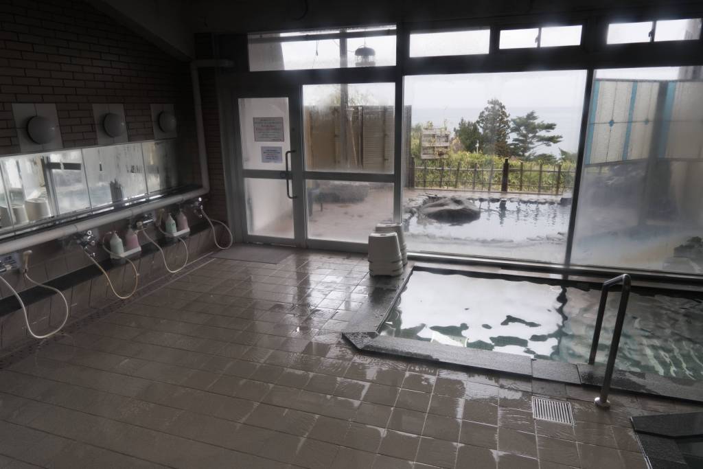
The Marin Side Spa in Taneichi is our big goal today. It has a nice onsen, which can be used for a fee of 600 JPY. We soak our bodies for a bit with a view of the ocean before getting some delicious food at Nakano Shokudo, a little local restaurant, where we also meet Yogetsu, a Japanese monk who is going to take over a temple nearby, succeeding his father as the temple priest. After dinner, we get groceries at a bigger supermarket as the next day does not have any grocery options. We walk for 20 more minutes to a campground close to the water and set up camp for the night.
Day 4: Taneichi campground to Kitasamuraihama campground / 26 km
It’s the next day around lunchtime, and we are looking for a place to rest for lunch. As sure as the truffle pig finds the truffle, Honza finds us the only restaurant in the middle of nowhere. We walk through the gates of a factory, and behind the production building, a small restaurant serves delicious food, all of it containing mushrooms. After mushroom ramen and mushroom soba with the local workers, we continue. We have to wade through a little river (there is an alternative road option), and climb up a rather steep forest before finding the trail again.
The effort is worth it; we get to see a beautiful serow, a Japanese goat/antelope. She watches us sliding around in the mud without a care in the world. Even when we sit down on a fallen tree to watch her, she just stares at us for a while before going back to her pastime. It starts to drizzle just as we are about to reach camp. Perfect timing to hide in the tent for the night.

Day 5: Kitasamuraihama campground to Odaiba Park in Noda / 34 km
In the morning, the Yokohama observatory, only a few kilometers after the campground, offers a beautiful view of the cliffs along the coast and a perfect mate and breakfast spot. We spend a lot of time just watching the seagulls on the rock islands in front before moving on.
The first bigger town we reach walking southbound is Kuji. We walk for a while to get to the center, the promise of food accelerating our steps. We pass a Kappa Sushi, a conveyor belt sushi place, and cannot resist. After a long lunch, we get some groceries and walk out of town quite late. We plan to walk only for a few kilometers and look for a camp spot. As we cannot find any, we end up walking after nightfall, finally setting up camp in Odaiba Park near Noda.
Day 6: Odaiba Park to Fudai park / 28 km
The trail is nice today, leading through nicely smelling pines. After the long day yesterday, we plan to take a shorter day today and relax a bit. We visit the Eboshiho Onsen, which has a nice view of the ocean, the daytrip is about 500 JPY and definitely worth it. What a wonderful feeling to be clean!
We had planned to go out for lunch and dinner, but sometimes things just do not turn out as planned. Lunch turns into a small portion of pasta to keep us going as we were too late for the restaurant, and dinner turns into a tent picnic. The 6 km that we expected after our onsen were, in fact, 9 km, and so we also miss out on the evening restaurant, arriving in Fudai after 7 pm. Luckily, a butcher has a ready-to-eat beef and bell pepper mix left, and a small store nearby sells chips, cookies, toast, and cake. The owner is very nice, calls restaurants to confirm that they really are closed, and adds two slices of cake for free to our order.
We walk out of Fudai towards the beach and set up camp in the park situated in front of the floodgate. It is such a weird feeling to be separated from the rest of the village by this immense concrete wall, knowing that in case of a tsunami, we are on the wrong side. This wall survived the 2011 tsunami and still stands to protect the village behind. Other walls along the coast have not resisted and bear witness to the force of nature.
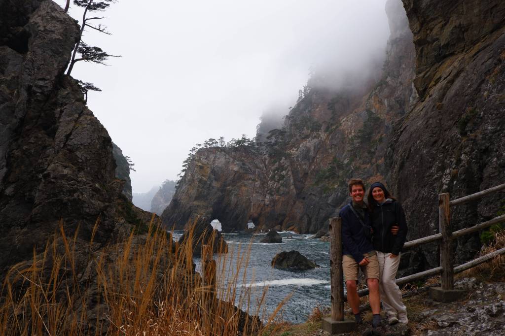
Day 7: Fudai park to Rikuchu Bentenzaki Lighthouse / 24 km
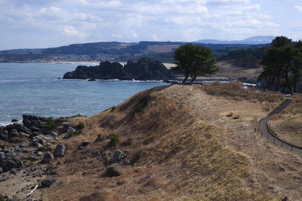
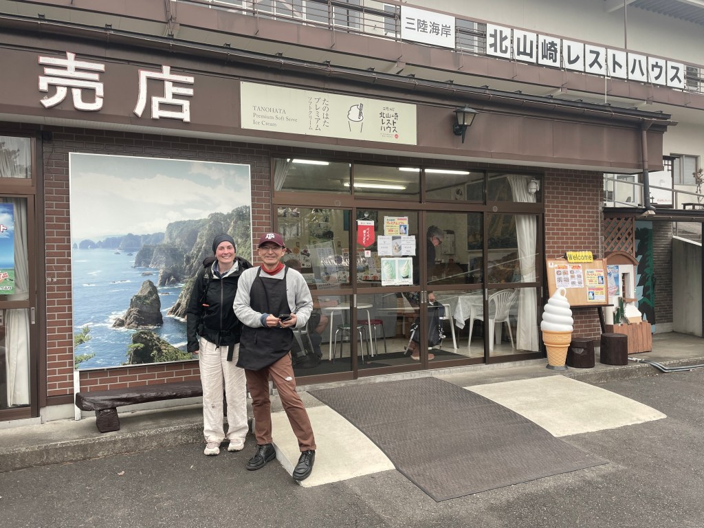
Our last full day on the trail, though we do not know it yet. The trail is very nice and starts quite flat on soft paths in the pine tree forest. We enjoy it tremendously and make it to Kitayamazaki Cape around 2 pm.
A thick fog has come up, and we sit in the little shop and talk with Aki, a local fisherman, who took over his father’s little souvenir shop. He makes us a nice soy sauce ramen and tells us where he was in March 2011, when the tsunami hit the coast of Iwate. He made a photo book of his experience of that day, showing before and after pictures of the coast and the villages.
When the earthquake happened, he was at a beach with high school students for a beach cleanup project. The sand absorbed the movements of the earthquake, and only a small landslide indicated that an earthquake had happened. As he and his colleagues were responsible for the students, they decided to play it safe and evacuate. Had it been only adults, he said, they would have continued and would have probably not escaped the water masses.
As earthquake alarms are regular occurrences, happening almost once a month and only rarely followed by tsunamis, the population doesn’t necessarily evacuate after each warning. According to Aki, it reflects in the number of deaths in 2011. While only 15 minutes passed before the wave hit the coast in the epicenter region, the population of Iwate, which is more north, had 45 minutes. We say goodbye to Aki and continue on the trail.
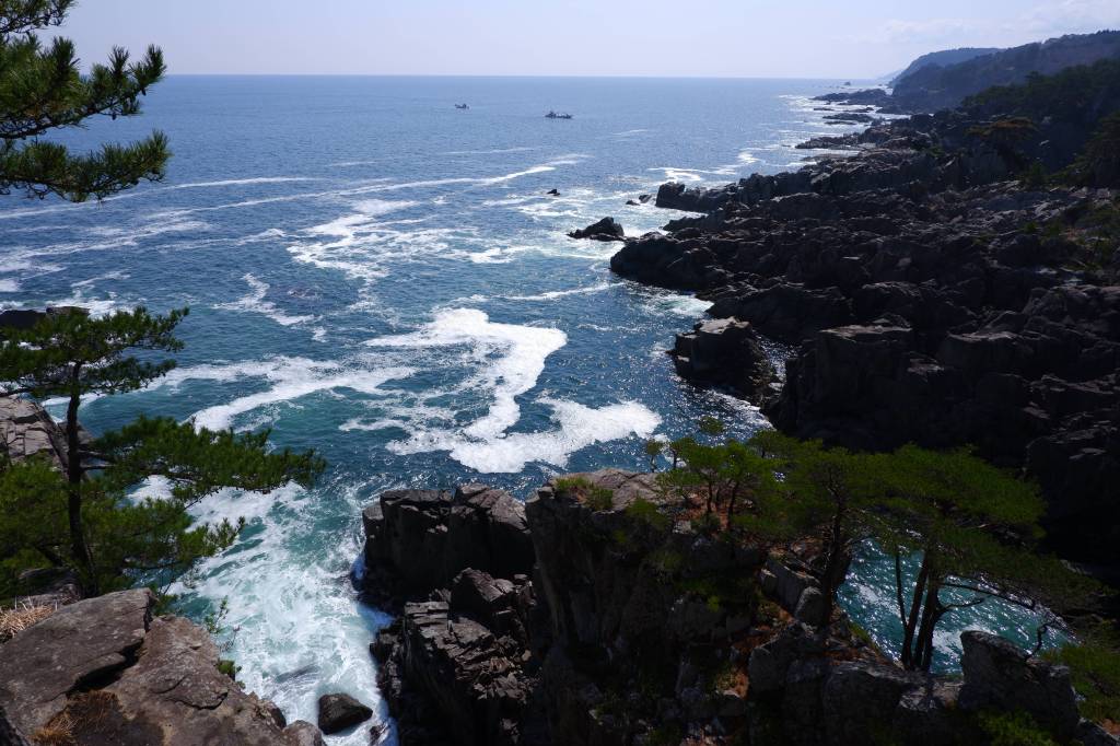
It goes down 510 steps and up on the other side. Luckily, we still are mostly on a forest path, which makes it nice to walk. But still, we are looking forward for a day of rest for our feet.
We pass the Rikuchu Bentenzaki Lighthouse around 5:30 pm, and as weather and wind seemed to be on our side, we decide to set camp on the flat space in front. We dine with a fine view of the rough coast. In the night, contrary to the forecast, the wind picks up, rattles our tent, and makes us shiver in our sleeping bags.
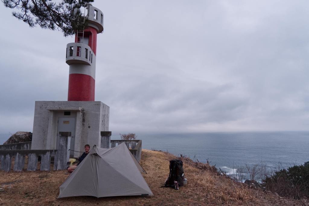
We do not sleep much, and when the morning comes, we spontaneously change our plan and decide to take the train back to Hachinohe and pick up our beloved camper, Rokkypokky.
What to bring
Camping gear is an advantage if you want to be more free and independent in your plans. However, there are many accommodations along the trail that can be used for more comfort, or for shortening the stretches between campsites.
Depending on the season, we would recommend carrying up to two liters of water. In early April, one liter was enough to last between villages where we asked locals and restaurants. In the summer heat, you would definitely need more.
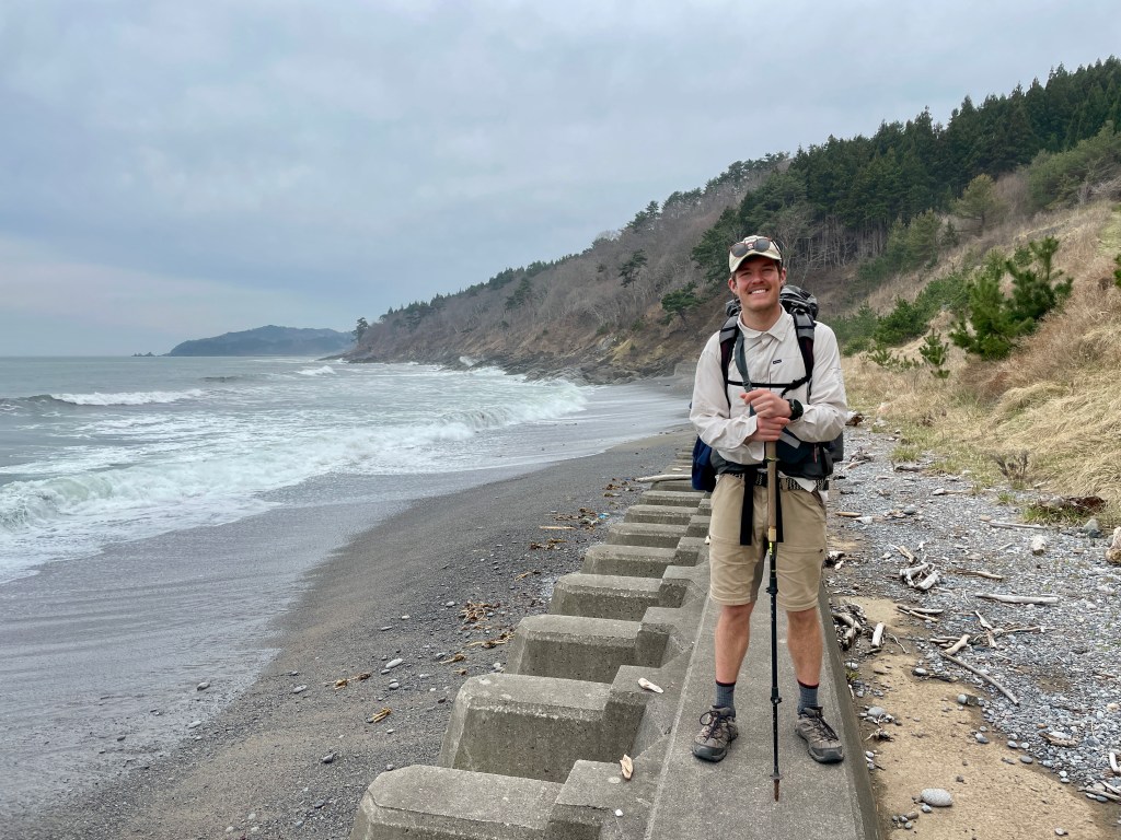
The trail is a mix of roads and trails. Heavy hiking boots are not ideal. We both had trail running shoes, an attempt to make the asphalt a bit less stressful for the feet. Even with trail runners, you could feel the impact on your feet, so don’t skip stretching!
Always apply the onion principle for layers. In April, the days were quite nice, but for frosty people, a fleece was very welcome. The nights were still cold, and I was very happy to have my down jacket. Overall, we’d say that April was a perfect time to walk the trail if you have the appropriate gear, especially a warm sleeping bag and a good insulation pad if you are considering camping.

Leave a comment